Off the Beaten Path in the Dominican Republic

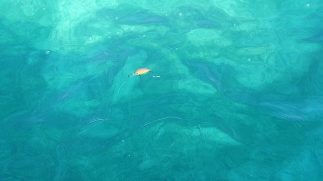
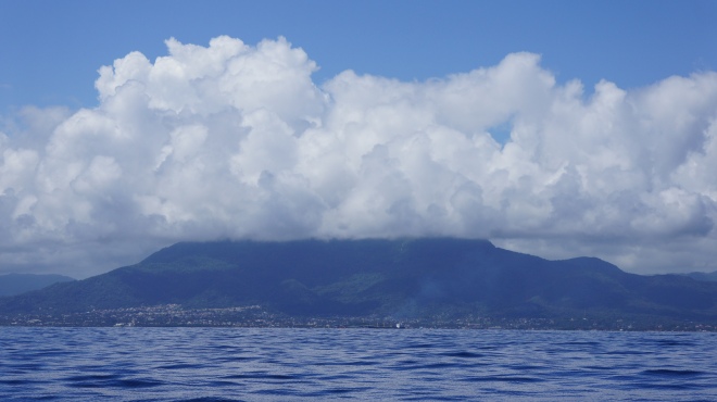
We’re around two miles off the coast of the Dominican Republic when it first hits me. That smell! A very distinctive aroma.
Earthy, damp, lush, green….
In fact, that’s it! That’s exactly what it reminds me of….a greenhouse.
The katabatic wind is picking up the scent from the land and carrying it downwind. It’s a wake up call that we’re entering a new country, but not only that, a new landscape too.
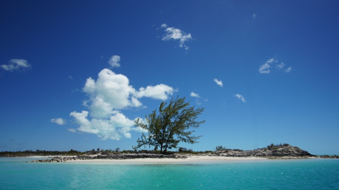
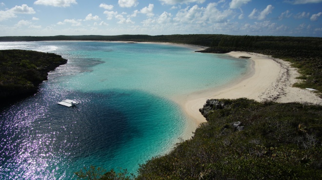
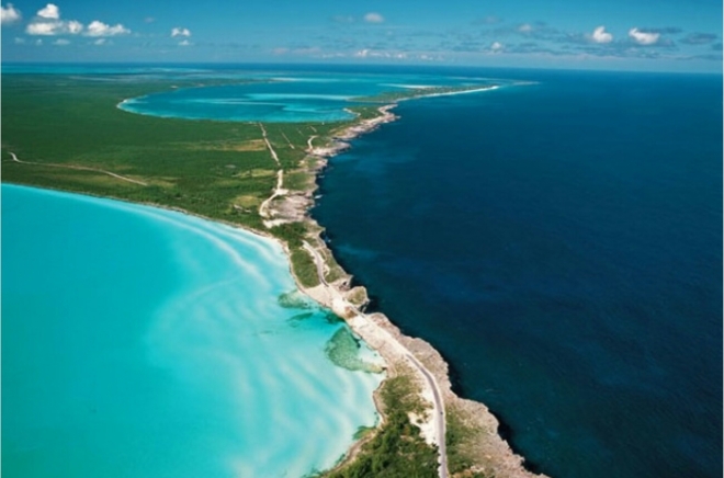
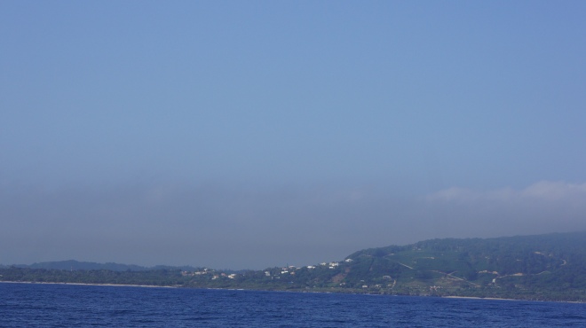
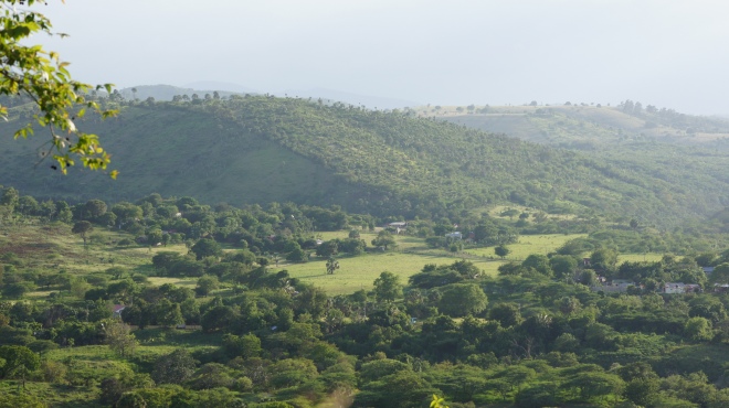
The coastline here is so different to what we have experienced over the last few months. The green hills emerge sharply out of the sea and the morning mist is clearing, slowly revealing small hillside settlements and occasional dirt-track roads.

SONY DSC

SONY DSC
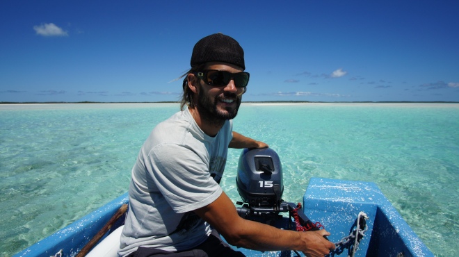
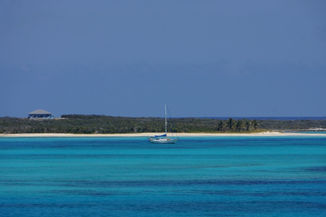
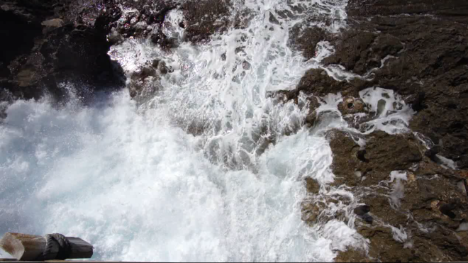
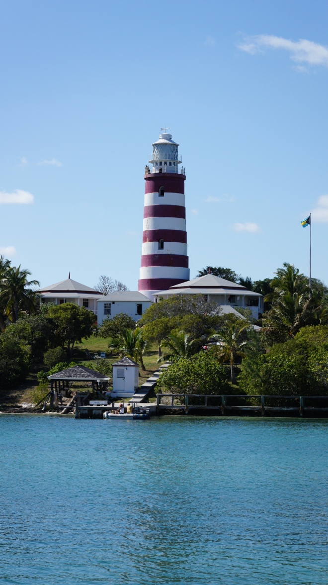
As we navigate our way in to Luperon anchorage the red marker buoy takes us precariously close to the rocky coastline. The water is calm here though and a sharp turn to the right after the buoy takes us into the anchorage area. Mooring buoys here are only $2 per night so we call the owner “Papo” on the VHF who meets us in his boat and guides us into our ball.
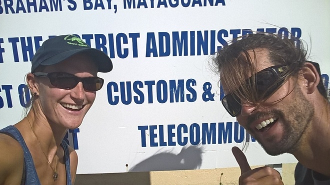
The process for checking into the Dominican Republic has become notorious within the cruising community. Stories are rife of the process being horrendous with around five “officials” boarding your boat at once. Comandantes have been said to be intimidating, rude and regularly demanding a monetary tip before they’ll do their job, so it’s something we’ve felt quite anxious about.
We’re boarded by three men all wearing civilian clothing. There’s one young slim guy, also a middle aged man who is the only one of the three who speaks any English and a large built man who doesn’t look very happy. The English speaking man obtains our boat paperwork and passports and passes them to the others who fill out some forms. I feel a bit on edge but I make them all a cup of tea in an attempt to be friendly. The large man seems to keep exclaiming, or deliberately “sneezing” very loudly. So loudly that it stops all other conversation each time. An intimidation technique? I don’t know, but he still looks like he’s ready to snap at any point.
After around 15 minutes, a few questions, no demand for a tip and just a quick glance around the boat they are satisfied and go on their way.
However, we still aren’t technically checked into the country and in fact their visit seems utterly pointless. We still have to visit a set of portacabins on the dock to speak with:
Immigration.
Customs.
Agriculture.
All of which need some form of “payment”, official or otherwise. It’s a long drawn out process but a few hours later we’re done.


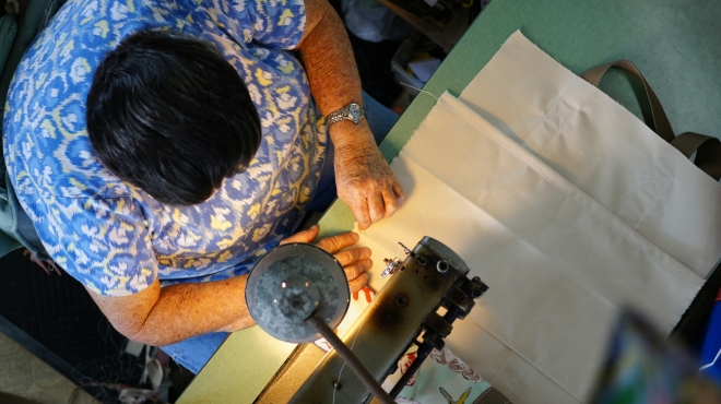
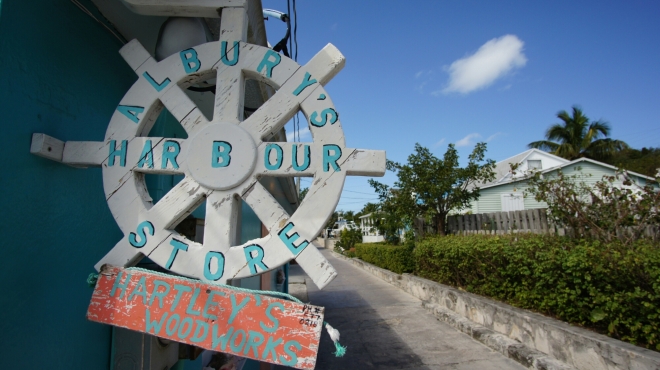
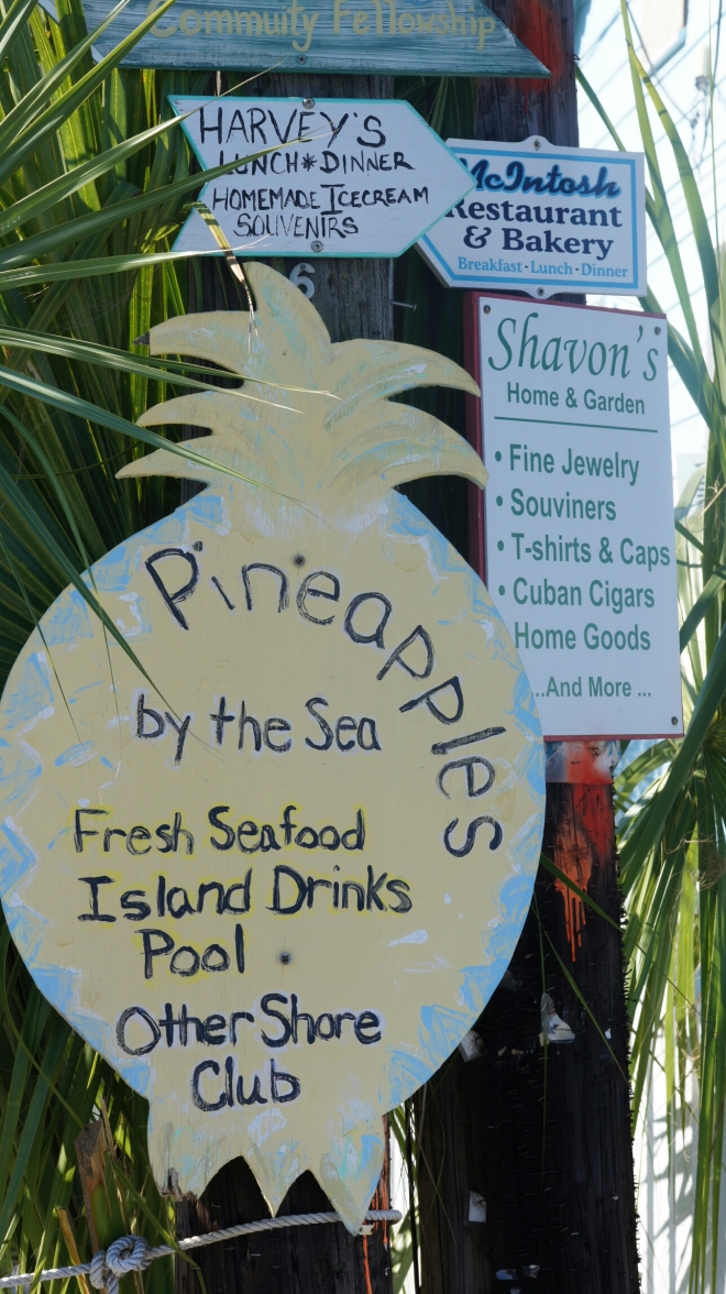
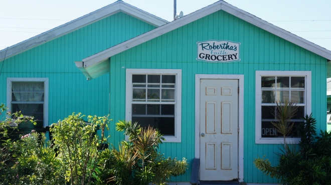
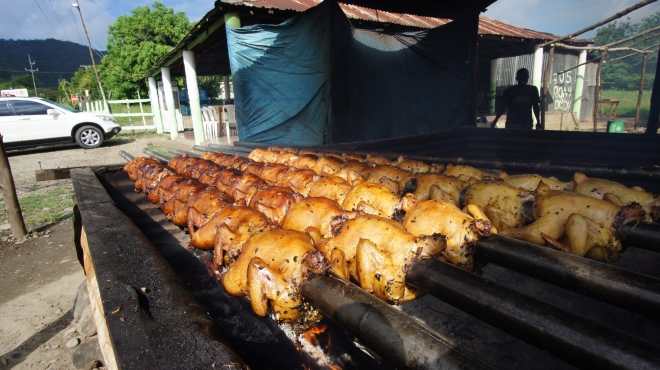
Luperon itself is a rundown town offering all the normal facilities including some marine focused businesses. There’s a small marina that has a reasonably priced restaurant and we discover Putulas, a hillside family run bar/restaurant offering home made breakfast and lunch dishes and a Jacuzzi!


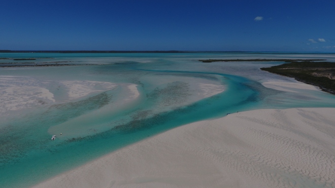
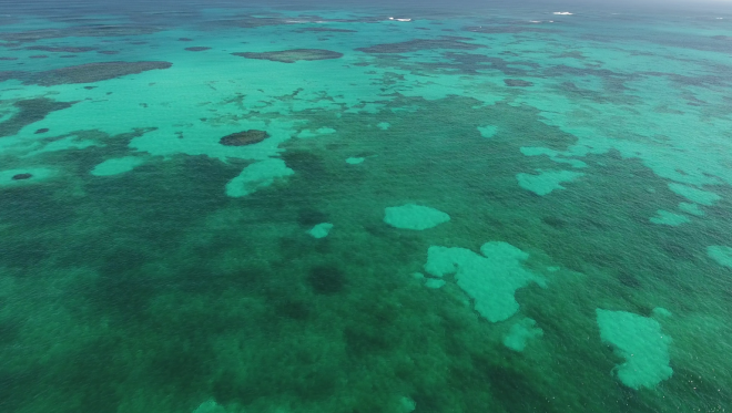
Anchorages are in short supply on the north coast so we decide to use Luperon as a base for a couple of weeks. The anchorage is set amongst the mangroves so the water is murky but it offers excellent protection from any weather.
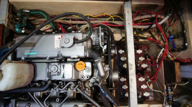
As always with boats there’s work to be done…a broken something here, a little leak there…and this time it’s the worst job of all.
A broken toilet.
We spend two days dismantling the system, removing pipes, soaking the pipes to dissolve the calcium build up caused by the salt water flush and identifying the actual problem. Long story short….we’ve fixed it, but it was not a pleasant task.
Next up on the To Do list: Reseal the Genoa track bolts.
We replaced some of these back in Florida but there’s more to do. The process involves removing the current bolts, digging out the old sealant and then replacing the bolts with fresh sealant.
With all ten bolts out we’re temporarily left with gaping holes in our decks. Sods law decides now would be a good time to provide us with the biggest downpour of rain we’ve experienced since our sailing trip started around five months ago! It’s absolutely torrential, so much so we can barely see the other boats in the anchorage. The rainwater begins to pour through the deck holes into our aft cabin and onto the bed. As one of us holds multiple buckets under the leaks, the other frantically sweeps the deck in an attempt to push away the pooling water.
This goes on for a solid three hours! We’re drenched!
When we have a slight break in the rain we rush to replace the bolts using a water resistant sealant and as it picks back up again we are relieved to see the water has stopped pouring in.

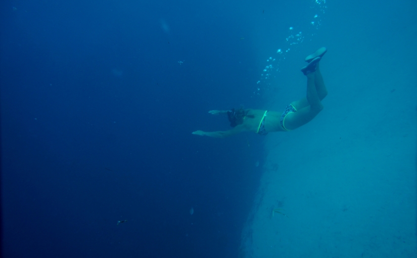
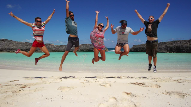
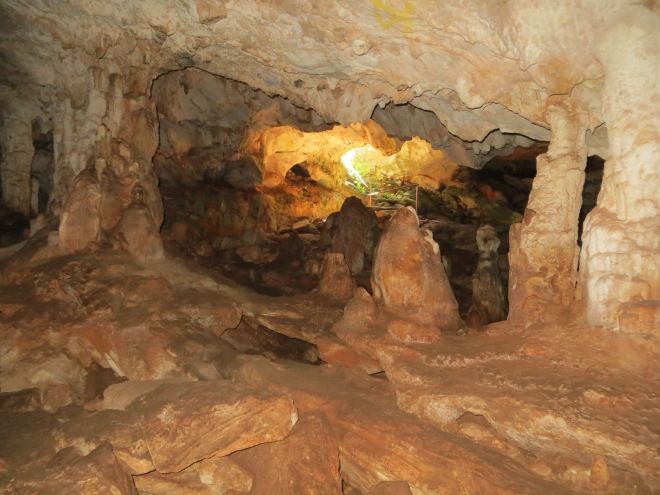
In need of having some happier times we plan a day out to a set of waterfalls with our friends from other sailboats here. But they’re not just any waterfalls. Oh no…these ones you can jump and slide down! Check out our vlog to see if we had the courage to jump off the highest cliff.

A few days later and we’re ready to go and explore again so we’ve hired a car. It’s so laid back here that the rental car guy doesn’t even take my name. He simply hands over the keys and we agree we’ll be back after a few days at which point we’ll pay for the rental.
We make our way up into the Cordillera Central mountain range that takes up much of the Dominican Republic’s central interior. This area has by far the highest peaks in the whole of the Caribbean, with some reaching over 3000 metres. Whilst we’ve decided not to trek to the highest peak there’s still plenty for us to explore at lower altitudes.
As we wind our way up the potholed roads the views are breath taking. Valleys lined with palm trees, green rolling hills and dramatic steep inclines surround us. It’s clear to see why the creators of Jurassic Park chose to shoot the film near here, it’s raw beauty is an eye catcher.

SONY DSC

We find some “interesting” accommodation on our first night (see our Facebook page) and some wonderful accommodation on our last night….glamping by a lake.


SONY DSC
A family run food shack on the side of a mountain road. Delicious BBQ’d chicken for just a few dollars.


Whilst we’re not particularly city people we choose to swing by Santiago, a large city nestled in amongst the mountains.


SONY DSC
Local farmers market. Much of the land surrounding Santiago is used as farmland as the soil is extremely fertile. Whilst many vegetables are grown, another popular crop is tobacco.


Much of the land surrounding here is used as farmland as the soil is extremely fertile. Whilst many vegetables are grown, another popular crop is tobacco. It’s been grown here for centuries and started being exported in 1679. It soon gained a reputation for being top quality tobacco but by the mid nineteenth century quality began to drop as the demand for mass cigarette production increased. Nowadays the Dominican has a booming high quality cigar industry that in fact sells more cigars than Cuba.

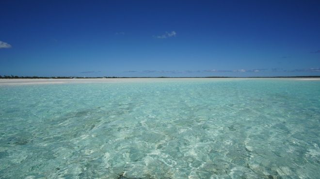
Back in Luperon and having been moored here for around two weeks we’ve learnt a lot about the local weather patterns. Early mornings are calm and still, as the sun rises we float upon reflective, glasslike waters. Mid morning as the sun rapidly heats the air the easterly trade winds begin to whip through the anchorage lasting all day. Without the winds to cool us we would be sweltering when the sun is shining and although no longer in the rainy season we do seem to be suffering an unusual amount of downpours. As the sun sets in the early evening the winds again die down to nothing for a calm evening and night. However off the coast things are different, katabatic winds generate over the land and rush towards the sea giving the opportunity to sail at night time. The next day the pattern generally repeats itself.
Having this knowledge on board helps us plan our next step, as always with sailing we are totally governed by Mother Nature. This stretch of our journey is particularly tricky as in order to travel east to our next port we must travel into the wind. We wait for a weather window when the winds are as calm as possible as to not be ploughing into strong winds and large waves.
Before we can leave however we must again have dealings with the comandante in order to obtain a despacho…a simple form with our personal details, our boat details and an allocated next port. These forms are a legal requirement and anyone trying to leave the harbour without one is stopped and made to return. The officials like to know exactly who is going where and when, and they can actually refuse to issue one of they feel the weather conditions are too dangerous for you to leave.
The forms are technically free to obtain, however we’ve heard the standard “tip” required in order for them to issue one is $15 per boat for an internal despatcho, and $25 for an international one.
We, along with our cruising friends, make our way to the comandante’s office which has extremely interesting access from the dinghy dock.

The remains of a bridge leading to the Comandante'
The remains of a bridge leading to the Comandante’s office

On arrival we’re told to go back down to the dock to speak with the comandantes there. We arrive on the dock to find two of the same men who boarded our boat when we arrived…the young male, and the intimidating large built man, neither of which speak English.

Luckily one of our fellow cruisers speaks Spanish and explains our requirements to them….three despachos, one for each of our boats. They protest and say it’s too late in the day to do it and that they don’t have any forms with them. When we explain that we will be leaving early the next morning they demand we come back in the morning to obtain the despacho as we must leave within one hour of it’s issue. Knowing they won’t be on duty early enough we negotiate for half an hour and a small tip to the younger more helpful man sees him head off on his moped to collect some forms. As he rides off I see in one of his pockets is a bottle of rum, in the other a handgun.
The larger intimidating man is continuously arrogant. His behaviour is not that of an official, or at least not how I consider officials should behave. He shouts to intimidate us, scowls and frowns at us as if we’ve done something terribly wrong. In fact we are just asking for a simple form to be completed which is what his employer demands of us and what he is paid to do.
For the next hour they very slowly fill out the forms with the required information and eventually hand them over to us. Collectively we leave them a tip simply because we’re relieved that it’s over and in the hope that they will turn a blind eye to us not leaving within an hour of receiving the form.
Our experience has shown these “officials” make your life very difficult just because they can. They will refuse to do their job in order for you to tip them to get what you need. In hindsight maybe we should not have tipped, maybe if we didn’t play their game they would learn to do their job properly. Who knows maybe they would still end with a tip in their hand, but it would be because of a good service and not through fear and intimidation.
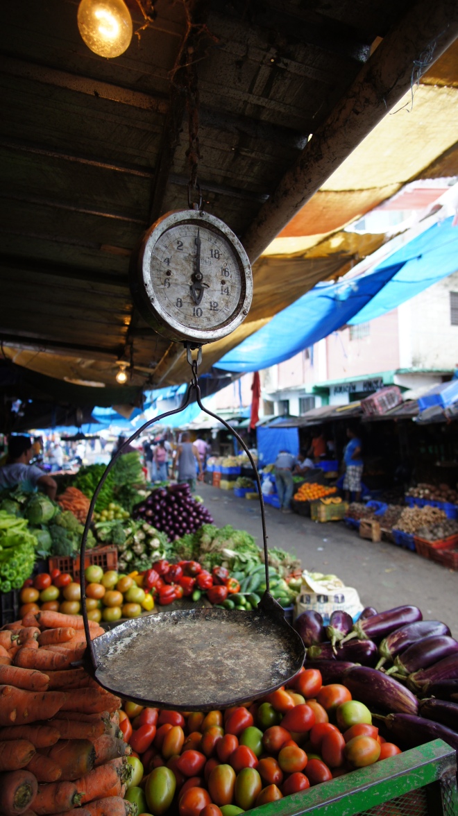
All over the Dominican people see us “gringos” as walking banks. We’re regularly asked for money, charged gringos prices instead of local prices and encouraged to give tips left right and centre.
I’ve been to the Dominican twice before, each time staying at all inclusive resorts when I was younger. You’re protected on those kinds of holidays to the extent where you tend to not really see the true culture and country. You’re simply shovelled around from one tourist trap to the next so I remained oblivious to the reality here. My honest opinion now is that whilst the country may cater well for a cheap and cheerful all inclusive package holiday, it has a long way to go before it’s truly cruiser friendly.
It seems a lot of locals simply think in the short term and don’t give any consideration about the long term effects their behaviour has on their economy. Are many of these people poor and desperate? Yes, but many of them are just greedy and are quick to take advantage when allowed. As always with travelling abroad you really do have to stay alert.

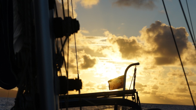
Returning to the boat with our despacho we discuss our plans. Our passage to Samana is estimated to take about 24 hours so there’s no avoiding the daytime winds, we just have to hope they’re as light as the forecast predicts and that any katabatic wind coming off the land at night time may enable us to sail.
In the morning we leave in company with our buddy boats Mauna Kea and Temerity and our journey goes well. We all take slightly different routes but remain within a mile or two of each other. The first leg of the journey sees reasonably light winds on the nose so we motor. As the sun sets we’re expecting to see the katabatic winds pick up but unexpectedly the trade winds strengthen miraculously out of the northeast meaning we can sail! We cruise along so quickly during the night that in the early hours we actually have to reef our sails in order to slow down as we’re due to arrive too early.

DSC04116.JPG

SONY DSC

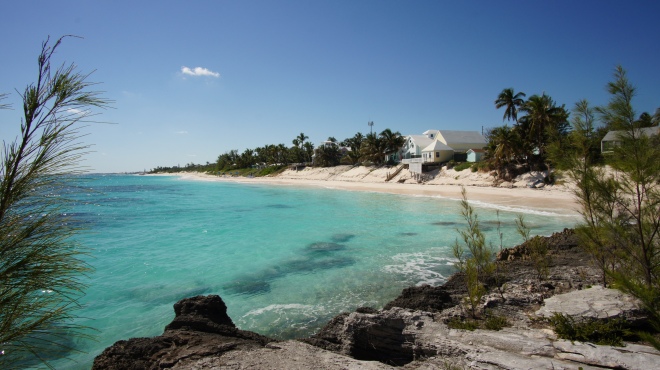
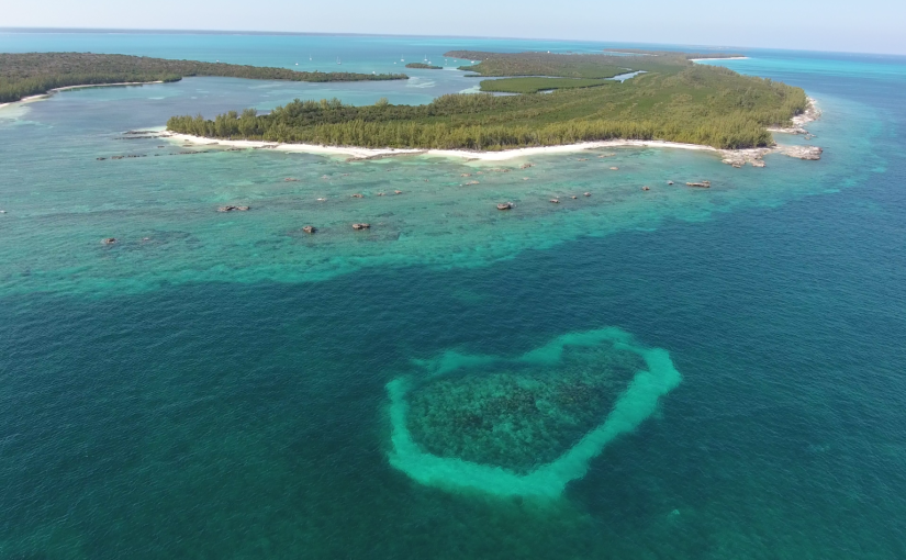
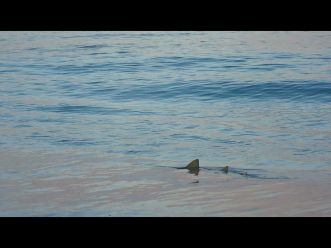
On arrival at Samana bay I keep my eyes peeled for whales nearby. Annually thousands of Atlantic Humpbacks migrate to the warm water here to find a mate and give birth to their young. We’re late in the season though and unfortunately there are none visible here today.
We anchor in Samana harbour and clamber into bed tired from our journey, only to be woken up half an hour later by a comandante asking for our despacho from Luperon. Bleary eyed I hand it over and then return to bed having been told that if we chose to stay here overnight we’d have an anchorage charge to pay.

SONY DSC
Samana harbour

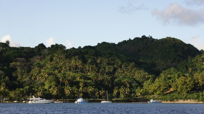
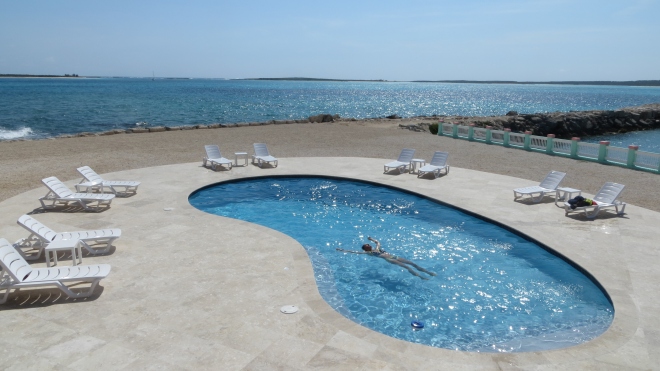
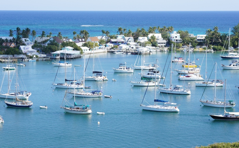
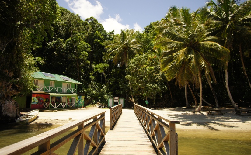
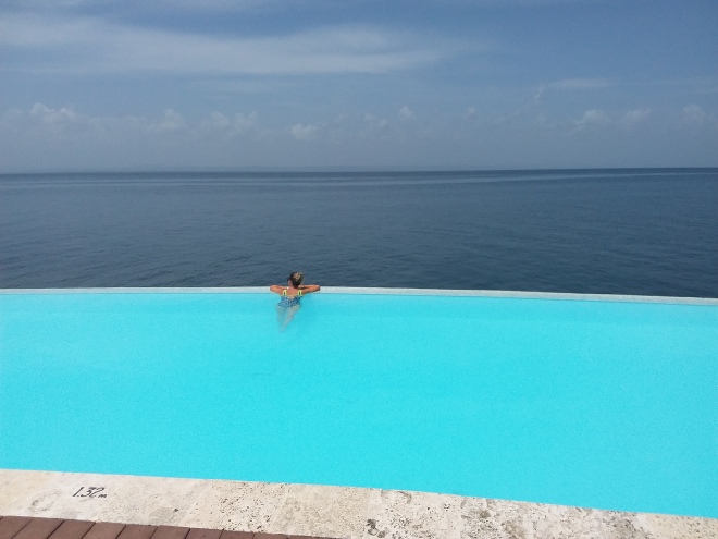
The next day at the break of dawn with lift the anchor and head around to Puerto Bahia Marina less than a mile away. It’s more costly than the anchorage fee in the harbour but at least here you get something for your money….luxury.

We decide to use it as our base for exploring this end of the island, but with such a nice marina it’s hard to tear ourselves away from it.
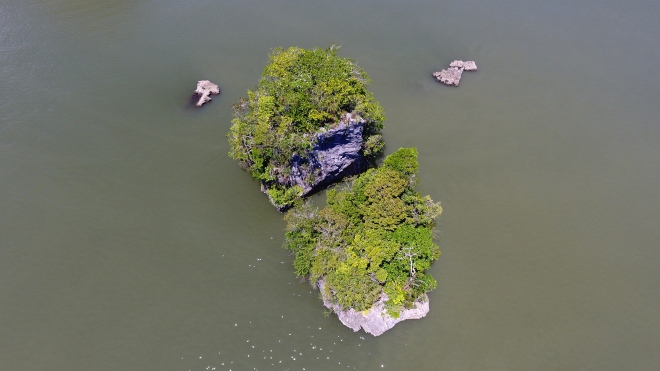
We meet up with some other friends on Malolo who are also staying at the marina and a group of us have a lovely day out aboard their catamaran to Los Haitises National Park. Can you believe that even for a day trip out of the marina you have to obtain a despacho?! It’s bureaucracy gone mad! Thankfully here at the marina the allocated comandante is far more professional, efficient and polite.

DJI_0194.JPG
Los Haitses National Park


A weather window appears for a crossing to Puerto Rico and we rush around one day trying to get everything up together so we can leave the following morning. I personally just don’t feel ready to leave yet, we’ve barely made the most of the marina facilities, I haven’t seen Santo Domingo the capital city and it all just feels a bit rushed.
Whilst completing last minute online admin Ben checks the entry process for Puerto Rico and establishes that as UK citizens entering US territory on a sailboat we must have a visa. This changes our plans instantly, we can’t leave tomorrow. We must obtain a visa first. It’s a blessing in disguise…
I will get to swim in the rooftop infinity pool
I will enjoy a massage in the spa
I will visit Santo Domingo after all!

20170515_110511

The visa process usually takes three months but there’s a small chance we may be able to have an emergency appointment. In order to apply we have pay the visa fee of $320 and then request the emergency appointment. If we’re not successful we will have wasted $320 as the next normal appointment is in three months time by which point we will be 500 miles away having skipped past Puerto Rico.
We take the risk, pay the fee and keep our fingers crossed.
Whilst waiting hear back from the authorities we make the most of the marina, socialise with friends and carry out work on the boat.
After a week or so I receive an email from the embassy…. miraculously I have managed to blag us an emergency appointment in Santo Domingo (despite the visa website pointing out that poor planning is not justification for an emergency requirement)!
We rush to the marina front desk and ask for a hire car ASAP. Within twenty minutes we’ve packed our bags, secured the boat, given the keys to our friends in case of an emergency, picked up the hire car and we’re en route to Santo Domingo over 100 miles away.
We’re late to our first visa appointment but they’re accommodating and we successfully have our photos and fingerprints taken. The day after next we’re scheduled in for the emergency interview so we have a day spare to explore Santo Domingo. We pop online and choose a hotel in the Colonial Zone, it’s perfectly located and has a large secure garage for our car too.
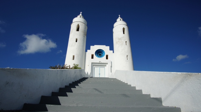
A short walk from the hotel we explore the local streets, shops and eateries. The architecture in the colonial zone is stunning. Gorgeous old buildings, many with balconies overlooking the narrow streets. There are places of worship, statues, parks and castles to explore too.


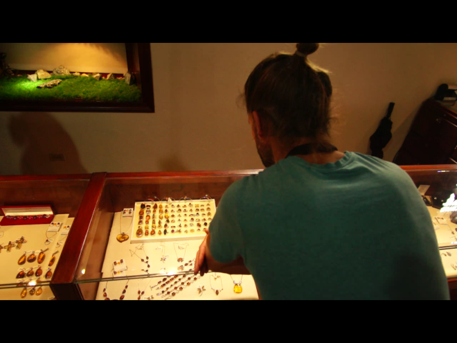
At the museums we learn about amber and the indigenous larimar stone that are both mined here in the Dominican Republic and after much deliberation I treat myself to a larimar ring. We also visit the rum museum where they make the spirit on site and offer free samples.

Screenshot_20170524-152430.png

dsc04454.jpg
The next day we make our way to the Unites States embassy where we have a casual “interview” that takes place at a glass partitioned counter much like you see at a bank. They authorise our visas and we’re advised they will keep hold of our passports and within a week they will be sent to a collection box half an hour’s drive from our marina where we will need to collect them. We were hoping we could obtain them here and now so we explain that we aim to leave the next day as there are safe weather conditions for us cross to Puerto Rico. The lady we have been interviewed by is really helpful and expedites our passports. Within fifteen minutes we have our passports returned to us with a US visa valid for ten years.
Passports in hand we drive for three hours back to the marina where we meet up with our friends and prepare the boat for tomorrow’s departure.
Puerto Rico…..we’re coming to get ya!

Out, out and away….

Silence, utter silence.

Only interrupted by the occasional splash from a nearby fish.

We’re drifting in the dinghy through Joe Sound.  It’s nearly low tide and the white sands of the sound are exposed. Cutting through them are the turquoise waters on which we float. The tidal current is taking us back out towards the sea and overhead the sun is shining brightly. The vast sky is bright blue only broken up with the occasional fluffy white cloud.
We spot several dark shapes in the shallows and as we edge closer they become clearer, two stingrays and a baby nurse shark. There are a few birds circling above us and in the distance we can see some people stood knee deep in water on the flats bonefishing.

DJI_0132.JPG

The opening into the sound from the ocean is narrow and reasonably shallow but a few boats have managed to squeeze in here to anchor. It seems some have been here a while. A dilapidated fishing boat has come to end of its life washed up onto one of the sand banks. It looks sad leaning over to one side, parts of it crumbling away. It’s a fairly common sight around the islands and always triggers my curiosity as to its story.
DSC03752.JPG

DSC03758.JPG

Walking along the edge of the sand banks the clear yet turquoise waters flow beside us, the sand itself is rippled as a result of the waters tidal movements. The water looks inviting, especially in this heat, but the current is made obvious by occasional floating leaves and twigs. As with many places in the Bahamas the current is strong and it’d be dangerous to go for a dip here.
We have a moment when we realise how fortunate we are to be here. Not only in the Bahamas, but right here at Joe Sound specifically. Had this location have been in closer proximity to the tourist trail it would not have the same feel. The raw beauty would still be here, but the experience would be very different.

It’s times like this when we’re off the beaten path we can really absorb our surroundings and appreciate the natural beauty. I guess that’s a major benefit gained from sailing the Bahamas, we really can escape from civilisation if we choose.

DSC03767.JPG

We’ve anchored in Calabash Bay in the north west of Long Island, the beach here stretches for what seems likes miles and it’s the perfect anchorage to explore Joe Sound from. Having spent a few days here exploring, repairing a tear in our sail and socialising with friends on sailing vessels Rat Catcher and Joda we find ourselves on the move again down towards Clarence Town. It’s located on the East coast so our route takes us around the northern tip of Long Island and then southeast along the coast for around 40 miles, crossing the Tropic of Cancer. We have to motor the whole way as the weather just isn’t playing ball, the wind’s coming straight out of the southeast. It’s not something we enjoy having to do but with time restraints and plenty more places to visit we need to get going.

We’re cautious entering Clarence Town harbour as there are breakers crashing on the nearby reef but we safely navigate our way through the swell and into the anchorage. There’s a surprising amount of protection from the southeast as a result of the surrounding reef, but we’ve heard the anchorage can get a bit hairy in northerly winds so as always we’ll keep a close eye on the forecast.

We’re excited to see what this end of Long Island has to offer as we’ve done no research prior to arriving here! We first stop off at Flying Fish Marina where we have the warmest of welcomes from Kevin the dock master. We’ve come over in the yacht to simply refill with fuel but Kevin makes us feel so welcome, he’s truly a credit to the marina. As a result we briefly stay at the marina to check out their facilities for future reference. Due to its location the marina mainly caters for sports fishing boats but sailboats are also welcome. I can highly recommend a dip in their freshwater pool overlooking the ocean and their restaurant also serves great food at reasonable prices.

DSC00543.JPG

IMG_2094.JPG

DSC03776.JPG

Whilst we’re at the marina we meet a lovely couple, Craig and Silke, having a coffee at the marina bar. They’re here on holiday and are staying at a hotel just down the road. They’re intrigued by our adventure so we invite them aboard, show them around our ‘home’ and show them the ropes (literally) as we leave the fuel dock and head back out to the anchorage.

Later in the day Ben and I attempt to visit Dean’s Blue Hole four miles away by dinghy. We’ve heard that it’s the world’s second deepest ocean hole where the water suddenly plummets from ankle deep to 663 feet deep. We fail in our attempt to get there, the ocean swell is just too much and the narrow entrance into the bay in which the blue hole is located is surrounded by rocks.

By chance later on at the marina I bump into Craig and Silke, they have a hire car and kindly offer to drive us to the blue hole the next morning. As I leave the dock in the dinghy and start to head back out to the yacht I see a small sailboat entering the anchorage area. It catches my eye as it’s emblazoned with “Solo Atlantic Crossing”! The boats moving cautiously and I’m intrigued so I motor over in the dinghy to say hello and see if everything’s OK. Mike the captain is from Poland, he has no depth sounder on board and therefore doesn’t know if he’s going to go aground. Unfortunately I can’t help him with that aspect but I can help in another way. He has no dinghy and his only way to get ashore once he’s anchored is by swimming. I offer to swing by later on and drop him ashore to save him yet another salt water dip! Ben and I are heading for a meal at the marina and we invite him to join us. It turns out Mike is intending to sail the 16.5 foot sailboat across the Atlantic solo in just a few weeks time. He tells us the boat is definitely capable as his friend has already sailed it across the Atlantic to get it here. The boat has no refrigeration and not even a head (that’s a toilet to any landlubbers)! I can’t say his plans are something I aspire to but he has a great attitude towards his adventure and we have the utmost respect for him.

The next day all five of us cram into a compact rental car and head off to Dean’s Blue Hole. A bumpy gravel “road” leads us off the main highway and down to the coast. At first glance the bay looks like many others, clear water lapping against the white sand. But as we walk around to the left we see the water turns from light turquoise to a deep blue. It’s here that the underwater world drastically changes and we can’t resist the opportunity to snorkel this unique location despite the drop off ledge making us feel a little anxious. In the shallow water my stomach skims the sandy bottom as I snorkel but as I edge towards the hole it slopes away before vertically dropping into a dark abyss. Around the edge fish are visible and I watch a small Barracuda dart off at lightning speed in an attempt to catch a smaller fish. As another fish swims over the ledge and down into the hole it totally disappears from sight into the darkness. I have to stop my mind conjuring up images of mythical human-eating sea creatures lurking in the deep water beneath me.

SONY DSC

A-B-M-DSC0090720170513_063659

Just as we’re drying off from our snorkel world champion free divers turn up to use the location for training. They have a floating platform located in the middle of the hole where they carry out relaxation and breathing techniques prior to immersing themselves into the deepest darkest depths. The world record for a totally unassisted free dive is a staggering 102 metres, completed by William Trubridge who’s here training today.

DSC03783.JPG

A short drive along the road is a stunning bay formed by the oceans deep water squeezing through a small gap in the rocks. Inside the bay the shallow, peaceful, bright blue water is edged by a crescent of soft white sand. It’s secluded and only accessible by walking over sand dunes from another nearby beach, as a result it’s perfectly deserted when we arrive.

SONY DSC20170507_075909

From Clarence Town we next make the jump over to Crooked Island where we anchor up at French Wells Point. This is a remote location with Crooked Island having only 330 inhabitants, it’s no surprise to find we have the anchorage entirely to ourselves. We’re surrounded by clear waters, rugged coastline, small uninhabited islands and mangroves. It’s bliss, the silence is gorgeous and the only other boat we see here today is a passing local fisherman. This is what the Out Islands are all about.
A walk along the west facing beach the next day brings a huge smile to my face. As I walk alone I wonder when it was that this beach was last walked along. It certainly wasn’t today, in front of me the footprint free sand curves off into the distance. I feel free and can’t resist the urge to run along the beach, stopping now and again to twirl around in the sunshine with my arms in the air. I really hope no one else is here, I must look a little strange, or maybe just happy.

In the shallow waters I treat myself to one of my favourite beauty treatments. A full body exfoliation using local natural products…AKA a good all over scrub using handfuls of the powdery white sand followed by a salt water rinse.

Exfoliation complete I wander back along the beach, looking for washed up sea glass and pretty shells as I go. Back at French Wells Point the chalky coastline crumbles away into the turquoise waters creating a dramatic effect. Hoping to find some lobster here we snorkel but we have no luck.

DJI_0159.JPG

DSC03818.JPG

A couple of days later we struggle to leave French Wells in our boat. On the way in here we established our charts are not accurate in regards to the depths at the entrance due to shifting sand. Visual piloting had proved successful for our entrance so we decide to follow our tracked route in from then, whilst also carefully observing the waters in front of us. We follow the deeper darker channel out but we’re now faced with a wall of light turquoise shallow water. The route we came in via is not an option, today it’s too shallow despite being at the same stage of tide. We seem to be stuck in here. We head to the right but it gets more and more shallow. The depth sounder shows just over 5 feet of water, our draft is 5 foot so I turn around but I don’t know which way to go next. With Ben on the bow he points towards another area to try. It looks shallow, but then again all of it does. We must be able to get out here somehow, but it’s going to be close.

As we attempt another route I watch the depth sounder again read worrying depths but we’re too late with our decision to turn around. With a bump the boat hits the seabed. The keel wedges into the sand so I quickly put the engine into reverse in an attempt to get us back off. Then with the wheel on full lock to the right and some forward power we slowly turn and start to edge our way back off the sand bank. The small waves make us bump along the sand but all of a sudden we’re off, albeit still in the shallow area we were trying to exit from. After another attempt at exiting the area we’re successful and I breathe a huge sigh of relief as I watch the depth sounder creep up…6ft, 7ft, 10ft and before we know it in less than a mile we’re in over a thousand feet of water.

After this nerve wracking start we continue on our longest journey to date, 100 nautical miles to Mayaguana which will be our final stop in the Bahamas. We’ve estimated the journey will take around 20 hours so we’re due to arrive shortly after sun rise tomorrow morning. We find we have to motor some stretches of our journey as the wind angle isn’t quite where we want it to be. But as we turn further south at the top of Acklins Island we hoist the sails and switch the engine off. This is what it’s all about, using the force of mother nature to propel us through the water and onto our destination.

IMG_2121.JPG

As the sun sets we begin our turns on watch at the helm. We’ve decided to do it in three hour stints each, one of us sleeping when the other is on watch.

It’s 4am and I’ve just started my last turn on watch. In between the odd cloud I can see stars twinkling and the moon is shining brightly casting some light on the ocean all around me. Sat at the helm with my feet up I’m struggling to stay awake, my eyelids keep involuntarily closing, I’m exhausted. The feeling is reminiscent of my times working night shifts, the thought of clambering into bed when this is over is so appealing. For now though I must stay awake, I check the chart and everything’s going well. Alan the Autopilot is behaving himself and we’re on track. As Ben sleeps in the cabin I’m kept company by a single crow-like bird who’s hitched a ride on our boat. We’re miles away from land so I can’t blame him.

When the sun begins to creep up over the horizon we’re both awake and we watch as the light fills the sky. We’re nearing Mayaguana and we’ve made good time, in fact we’re a little early so we reef the main to slow us down. We arrive at Abrahams Bay around 7.30am but the sun is not high enough in the sky for us to be able to safely navigate our way through the coral heads to the anchorage. A sailboat beached on the reef nearby is a stark reminder of how cautious we need to be here. We anchor just outside of the bay so we can get some much needed rest, we’ll move the boat around into the anchorage later in the day.

We spend a few days at Abrahams Bay whilst we wait for suitable weather to leave. There’s not much here at all, just a small settlement and a handful of residents. Due to it being the most easterly Bahamian island one facility they do have here is a customs and immigration office. We pop in one day to officially check ourselves out of the country, something we forgot to do when we left the USA three months ago.

WP_20170412_10_06_42_Pro

The Bahamas have been the perfect destination for sailing, if not a little challenging at times. The memories of crystal clear waters, white sandy beaches, rugged coastline and small cays will last a lifetime time.

For now though with our passports stamped and the boats departure papers completed we’re ready to head for our next destination, the Turks and Caicos islands.

The Bahamas at it’s finest

The Exumas are said to be the ultimate cruising grounds in the Bahamas. The photos you see in the magazines of beautiful clear waters and white sands are likely to have been taken here and I can confirm, the camera doesn’t lie.

The Exumas consist of 365 beautiful islands dotted over 130 miles.

They’re a special place, so special that the likes of Johnny Depp,  Shakira and David Copperfield have all bought their own piece of paradise here.

Over the last month or so we’ve spent time cruising between the Exuma islands. Exploring the islands that are yet to be privatised and enjoying the crystal clear waters.

Pipe Cay

On our initial journey to the Exumas from Eleuthera we were joined by Ben’s sister. Not only did she bring our new fishing reel with her but also a dash of good luck. The journey over to Staniel Cay saw us catch our first Barracuda! And our second!

Staniel Cay is located a third of the way down the Exuma chain and acts as a central point for tourism. There’s a yacht club and marina there and also a small airport with regular flights from Nassau which made it the perfect place to pick up Ben’s brother in law. With all of us aboard, we were ready to start exploring.
Around Staniel Cay we ticked off a couple from the “must do” list….

Thunderball Grotto –  an underwater cave system accessible by snorkelling under a rockface that sits a few inches above the waterline at low tide. Once inside the cavern opens up and there’s light  bursting in from all angles, including through the roof.  Under the water the visibility wasn’t perfect due to the preceding  bad weather. However we could still see the schools of fish who had a feast on the dog biscuits I brought for them. The grotto got its name from the 1965 James Bond spy film “Thunderball,” which was shot there. It was also the site of another James Bond film, “Never Say Never Again” in 1983, also based on the Thunderball novel.

Pig Beach – where the famous piggies live on the beach and swim in the sea. It’s located on Big Majors Cay and all day every day speedboats turn up with tourists wanting their own pig selfie. Thankfully when we were there it was pretty quiet and there were only a handful of people visiting. Maybe that was as a result of a few of the pigs dying earlier that week, or maybe because the sun wasn’t shining so brightly that day, I’m not sure.

As we worked our way up the Exuma chain we stumbled across a stunning location called Pipe Cay. In between the islands the water is mostly shallow, but there are also deeper cuts created by the strong current that runs through here. The water is turquoise blue and at low tide the sand banks are exposed creating gorgeous footprint free beaches, some only accessible by boat. We initially anchored right in the heart of it all but after one night worrying about the strong current we were in, we moved around to the other side of the island. It turned to be a great decision as to our surprise we found a free dock to moor up at! That’s pretty much an unheard of situation! Once upon a time there was a US navy Decca station here. A channel had previously been dredged allowing large vessels to access the concrete dock to offload deliveries. Now abandoned, the channel and dock are still present and conveniently the humongous cleats still in good condition. After a quick snorkel to check for obstructions we followed the rusty channel marker posts into the dock and moored up.

The old Decca buildings had seen better days but it was interesting to have a nosey round. A short walk to the other side of the island brought us out onto the above mentioned sand flats that stretched out onto the distance. Next to our free dock was a small beach and there were a few coral heads a short dinghy ride away for snorkelling. It was here I had a fright whilst snorkelling. Myself and Ben had gone off with our spears to find some dinner. We were focusing on a small coral head but the bigger fish knew what we were up to and swam off elsewhere.  I left Ben at the coral head and ventured off in the water to see if I could find them. For a while all I could see was a sandy bottom, I was glancing around left to right but couldn’t see any more coral heads. As I turned further to my right a large dark mass made me jump, I was faced with a gigantic stingray. He was only a few metres away and was heading directly for me. His span was probably 5ft, big enough to intimidate me. I tried to swim out the way without making too many harsh movements in his direction, keeping an eye on his tail the whole time. Really, I had nothing to worry about, they’re only likely to sting if they are attacked. In fact he moved slowly and graciously past me, within just a couple of metres. So peaceful and calm. Reassured by his lack of interest in me I signalled over to Ben to follow me as I swam slowly after the ray. After a few moments I lost sight of him and as I turned to ask Ben if he saw it, I realised he was still back on the coral head trying to spear a fish!
As we sailed further north we entered the Exuma Land and Sea Park, a National Park focusing on conservation of the environment. It’s a “no take” zone, meaning you cannot remove anything from the 176 square mile area. This includes fish, lobster, shells, etc.

Anchoring is also restricted in areas in order to protect the seabed, instead there are fixed mooring buoys available at a cost. At the heart of the Exuma Park is Warderick Wells where the office HQ is located. It is similar to the Pipe Cay area in a way, there’s a deeper dark blue channel curving it’s way through the shallow white sand banks. Here we took a mooring buoy for a couple of nights and explored the island and surrounding waters. Bens sister and her husband enjoyed a long walk around the island one day whilst myself and Ben chose to explore the underwater world once again.  We snorkelled right off our yacht and unknowingly timed our snorkel perfectly. As we took our first look underwater we saw three large rays gliding along in formation. The ends of their wings were pointed, they had a speckled pattern and under each of them was a fish taking shelter in the rays shade. As they effortlessly moved through the water we tried to follow them but we couldn’t keep up.

Arriving at Warderick Wells
Warderick Wells

We next headed up to Norman’s Cay which we were excited about, but on arrival we were a little disappointed. It wasn’t quite what we expected. There seemed to be only one business on the west coast where we anchored offering accommodation, a bar and a restaurant. We popped in for a drink and it was very swanky by Bahamian standards. The decor was shabby chic but clearly expensive and the comfy sofas and armchairs hugely appealed to us. The welcome we received on the other hand was not so great. OK, we all looked a little scruffy, show me a liveaboard sailboat cruiser who doesn’t! The staff were a little frosty but we bought a round of drinks and sat down outside to enjoy them. When we asked for the dinner menu as we were considering coming back in the evening the suggestion made by the staff was that we couldn’t afford it. Umm, I think we should be the judge of that thank you. As we sipped our drinks I popped back inside to ask for the wifi password, the blunt  response I received was “50 dollars” for a second I thought she was telling me the password, then I realised when she repeated it that they charged 50 dollars for the wifi password. I involuntarily laughed in her face, told her I think I’d go without it in that case and walked out. We swiftly finished our drinks and left, needless to say we didn’t spend our money there on dinner that evening.
All too quickly it was time for us to make the voyage back to Eleuthera for our guests to catch their flight home. The crossing went well, the sails were up and we were averaging 6 knots. As I looked off to the port side I saw a pod of dolphins skimming the waters surface quickly approaching our boat.  Suddenly we were surrounded by them, off to either side of the boat they powered through the water, inches under the surface and at the bow they played in the tumbling water. I’m yet to find another animal that brings a smile to so many faces so easily. Then suddenly, as quickly as they arrived they disappeared into the depths of the ocean.

The 10 or so days we’d spent in the Exumas had been a great introduction, but it wasn’t enough. We’d had a glimpse and we wanted more, so once our guests had departed we planned to make our way back to the Exumas. We were forced to wait in Rock Sound for nearly a week due to weather but it gave us a chance to catch up on a few chores, or at least try to…

In our rental car we dropped our washing off at laundromat, putting it on a long wash cycle. In the meantime we went along the road do a food shop. The local store was a run down building on the side of the road, from the outside you could barely tell it was a food shop. It was clearly a place where the locals shopped, there were no other cruisers or tourists there. Inside we discovered they had a wide variety of produce so we decided to really restock the boat. Mid shop there was a power cut, but the lights weren’t out for long, and within a few minutes we could see what we were doing again. By the time we got to the single till point the trolley was overflowing. We offloaded each item onto the short conveyor belt causing a queue to form behind us. As the running total hit $250  the cashier joked, “I hope the card machine works”. We laughed, agreeing, and continued to load the scanned items into the trolley. Little did we know that in fact our card payment was not going to work. The power cut had caused the payment machine to not function correctly and we didn’t have enough cash to cover all this food. After several payment attempts we left the trolley at the till and headed off to the only ATM in town only to discover the power was still not back up and therefore the ATM was not functioning. The shops own generator must have kicked in causing us to think everything was back up and running. We were mulling over our options whilst en route back to the shop and decided to swing by the launderette to swap our clothes over to the drier. You guessed it. They didn’t have their own generator so our clothes were unwashed, soaking wet, and stuck in the washer. Back at the food shop we tried to persuade them to allow us to take the food today and return tomorrow to pay. However they weren’t feeling very trusting so we were left with no other option than to leave all the food behind. What a waste of an hour and a half.

Feeling hungry we grabbed a bite to eat at nearby Netas Food Shack, run by a local lady who sells cooked food from her home. It was a quirky location and Neta was certainly a quirky person. A small lady with orange hair and prominent cheek bones. Her business/home had a small convenience store area to the left as you enter. To the right in front of the window there was a plastic table and two chairs, the kind you would buy in a garden centre for outdoor use. On top the table were a couple of placemats just about visible under the clutter. This was the table used for paying diners.

Netas Food shack

From Netas small menu we opted for fried chicken and rice for $6 per portion. Whilst Neta cooked the food on a gas hob at the rear of the room she told us about herself as we took in our surroundings.  During her life she’d had 10 children but sadly 4 of them had passed away. She now lived here alone with no family nearby. Despite all of this she had a really positive outlook on life and told us “just live, that’s what I tell my children, just live. You two cling to each other and just live”
As we sat at the plastic table our surroundings gave us a further insight into her life. There were personal items of hers, photos of her family on the walls and we noticed 3 bibles on a table to the side of us, all open on a different page. She explained she reads all of them at once, when she has had enough of one she moves on to the next.

The food was proudly served up to us and we continued chatting to her as we ate.  When the time came for us to leave she kindly offered us a bag of her handmade coconut cake. We accepted. I think she’d been grateful for our custom, and our company.

Netas coconut cake….sugar rush!

In an attempt to resolve our dilemma we drove to the next town but there was no electricity there either.
We had no cash, no clean bedding, no fresh food and no way to put petrol in our rental car. Oh and our clothes were still stuck in the washer!

Who said this cruising life was stress free?!

Eventually we managed to resolve the situation. We used petrol from our dinghy to refill the rental car and the electricity came back on the following day so we were able to finish our washing and complete a food shop (again) at a different store.

When the windy weather cleared we began the 10 hour run back to the Exumas. To our surprise, in almost exactly the same spot we caught the barracuda previously, we caught a mutton snapper! As Ben reeled it in we could see a barracuda following, attacking the snapper on our line, trying to claim it for his own. No such luck Mr Barracuda. It’s ours!

On arrival in the Exumas we anchored at Black Point, Great Guana, the water was lovely and clear. Below us were numerous star fish sat on the sandy seabed. It was sunny and there was no current so I dived in the water and swam ashore and back again to cool off. Whilst in the water I took the opportunity to scrub the hull of the boat to remove any weeds and barnacles. As I covered the length of the port side Ben scrubbed the starboard side. The water quality here was so good we fired up the water maker and filled one of our tanks with 50 gallons of fresh water, taking around 3 hours. It’s not ideal having a generator running in the cockpit for that amount of time but having a water maker is an amazing on board bit of kit. One day I’ll understand how it turns salt water into freshwater, for now I’ll just assume it’s magic!

Incoming squall one afternoon at Black Point

A few days later we sailed down to Little Farmers Cay practicing reefing the main and heaving to on the way down. At Little Farmers we enjoyed a few games of pool at the yacht club and a bite to eat before wandering into the centre of the village. The sleepy fishing village had a lovely feel to it. As we wandered we passed the local fisherman stood knee deep in the harbour water chopping up his catch on a concrete slab selling it to passers by. As the stingrays swam round his ankles looking for the scraps I chatted to him to get some top tips. He’s a spear fisherman and catches all his fish in up to 10 feet of water. I decided I must be looking in the wrong places as I never see fish as big as the one that lays in front of him when I spear fish!

Local fisherman at Little Farmers Cay
Relaxing at Little Farmers Cay dock

Further down the Exuma chain we stopped at Musha Cay, we didn’t actually stay on the island itself (Google it!) but we did anchor right outside for a few nights. From here and from another anchorage by Rudder Cut Cay we snorkelled a plane wreck and a sunken piano. At the plane wreck one of the wings sat about two feet above the sand seabed. Underneath was an abundance of fish, all closely gathered taking shelter from the sun’s rays penetrating through the shallow water. I’ve never seen so many fish all huddled together in one place before. They soon scarpered when we got too close though.
The sunken grand piano also features a mermaid and was a piece of artwork intentionally sunk in 15ft of water by David Copperfield who owns the cays here. Having seen it online previously I was excited to snorkel it, but actually, it’s just a sunken piano sculpture…I’m not sure what else I was expecting, but it was a bit of an anti-climax.

What did put a smile on my face however was the calm weather allowing me to fly my drone near Rudder Cut Cay. The views here were striking and we also found an interesting mini cave only accessible from the water.

A couple of miles out from the west side of Musha Cay are sand banks that are exposed at low tide. It’s a strange place to visit, there you are walking on a sandy beach that’s totally surrounded by water. As the sun set there one day we wandered along whilst watching kite surfers, it made us think…we must try that sport sometime!
From here we hopped down to Lee Stocking island for a couple of nights and then onto Georgetown. Whilst sailing to Georgetown I put the fishing rod out as we were running low on fresh meat/fish. For weeks I’d been hoping to catch a Mahi Mahi as I’d heard they were delicious…and also they’re bright green and blue which I think is pretty cool! Well that day was my lucky day, not only did I hook a Mahi Mahi, it was a pretty large bull. It took me half an hour to wear him out on the line and it was a two person job to actually get him on board! He weighed in at around 23lbs and measured 123cm long. I kept smiling to myself all day, really pleased with my catch, but I wanted Ben to be able to take some credit so I “let” him do the honours of gutting and filleting him 😉

On arrival at Georgetown we dined on pan fried Mahi Mahi fillets and the following day I made Mahi Mahi ceviche which involves letting the raw fish sit in lime juice and seasoning. This allows it to “cook” the outer edge of the fish, leaving the middle raw and tasting delicious. Some of the fish also made it into my homemade sushi and the rest was crammed into the freezer to be enjoyed another day.

Georgetown is a very sociable place for cruisers. The anchorage is large and there were hundreds of cruisers anchored when we arrived. Some people stay for days, some for weeks, others for months and there are even some who have been there years! There’s numerous activities going on at the various local beaches on Stocking Island including volleyball, morning yoga, water aerobics, walks, BBQs, bonfires and much more. Across the other side of the anchorage is Georgetown itself which offers all the amenities needed…hardware stores, supermarkets, banks, liquor store, laundromat etc. If cruisers are heading south through the Out Islands this is the last decent sized town for provisioning. So during the week we stayed here this is exactly what we did, restocked the boat again, refilled gas canisters, caught up on laundry, used the ATM etc. We met some great fellow cruisers at Georgetown and enjoyed walks on Stocking Island, drinks on the beach at sunset, a hog roast at Chat n Chill beach bar and socialising aboard others boats. I again managed to get the drone up and captured the stunning coastline of Stocking Island and the anchorage areas.

In between the fun and games we carried out repairs to our reefing webbing on our mainsail and also located a rip in the sail which needed to be repaired. With our departure planned for the next day it’d have to wait. It was time for us to leave thriving Georgetown behind and make our way out of the Exumas and onto the Out Islands….remote, peaceful and barely inhabited.

Eleuthera, the island of freedom

It’s 8pm, the moon has risen and the stars are shining brightly in the sky. Ben’s stood at the bow of the boat discovering the underwater world by the light of his torch. It’s the night before we make the crossing from the Abacos to Eleuthera. We need an early night as we’re due to be up before sunrise to commence the 11 hour crossing. Unfortunately mother nature has a different idea and puts us in a bit of a sticky situation resulting in panic and a sleepless night… but I’ll tell you all about that another time.

The following day we leave Channel Cay in the Abacos in darkness to start the 60 nautical mile journey. As we make our way through the deeper waters of the North East Providence Channel we have the sun rising to our port side, and the moon setting to starboard. We have good weather conditions and reasonably calm seas….just how we like it! The wind is coming from a perfect angle so we hoist the sails and sail the whole way to our destination, Royal Island, Eleuthera.

Royal Island

The island itself is private but it centres around a natural harbour providing protection from winds from almost all angles. We pick a suitable spot and anchor for the evening. After anchoring we see a young couple from another yacht coming over to say hi, it’s the same yacht that had a bump in the night during a storm back at Green Turtle. We welcome them aboard for a quick catch up, we’d love to be feeling more sociable but after a sleepless night last night and a long journey today we both are in dire need of dinner and our bed.

We spend a couple of days around the Royal Island area exploring some old ruins and snorkelling a shipwreck. The Arimoroa was a Lebanese steel freighter carrying fertiliser that caught fire and was intentionally run aground in order to save the crew. Fifty seven years on and the 260 foot remains have made a fantastic home for thousands of fish, varying from small colourful wrasse to large barracuda and many others in between. The bulk of the wreck sits 25 feet below the surface of the water, as we snorkel we look down onto the fish darting in and out of the steel panels, pipes and crevices.

At one end a large part of the freighter juts up and out of the water, breaking the surface at low tide. It has the effect of a tower but it appears this was possibly the stern of the vessel. The side facing the rest of the wreckage has the remains of brackets and panels allowing fish to hide within. As we swim around the other side of the imposing structure it smoothly drops away, like a wall, straight down to the seabed. On the almost vertical surface coral has grown providing a colourful display and two silver barracudas are patrolling the waters in search of their next meal. We follow suit and grab our spears from the dinghy. We successfully catch dinner and promptly get the fish out of the water and into the dinghy to prevent a hungry barracuda stealing our catch. As we continue to swim around we spot a large fish lurking around the wreck around 20 feet below us. It appears to be 3-4 feet in length with a rounded, dark body. We don’t know what kind of fish it is but going by its size and evil looking face we don’t want to get too close.

After an hour in the water I get a little chilly so venture back into the dinghy where I sunbathe to warm up. Ben remains in the water and every now and again pops back to the dinghy with another fish protruding from the water on the end of the spear. The sun is warm today and there’s a gentle breeze. Laying on the dinghys seat, slowly bobbing around with the waves is nice and relaxing, that is until I’m splashed with water from one of our catch flapping around in the hull.
I look up to see Ben swimming fast towards me, his spear isn’t out the water so he hasn’t caught a fish. A quick signal by him of his flat hand raised upright against his forehead tells me there’s a shark in there with him. I jump up and help him into the safety of the dinghy and we head back to our yacht.

SONY DSC
Ruins at Royal Island

Over the next couple of weeks we sail between anchorages in the Eleuthera area, exploring different destinations as we go.

At Spanish Wells we pick up one of the few moorings available, it’s a pretty tight spot but I successfully manoeuvre our yacht and Ben picks up the mooring with a boat hook on our first attempt. Spanish Wells is a traditional Bahamian fishing town and we’re amongst the hub of activity. We watch large fishing vessels come and go through the dredged channel. The docks are lined with more vessels and workers ready to help bring in the days catch. The vessels are so large and the channel so narrow, an announcement is made over the VHF for each departure and arrival so other mariners stay out of the way. It’s not the most picturesque of places here but it’s interesting to see the world go by.

20170210_154022.jpg
Spanish Wells

We like that the town’s not aimed at tourists and I would imagine the majority of their visitors are cruisers. There are a few facilities here we require including a supermarket and a hardware store. After wandering around for a few hours we discover a locals bar that serves food and drink at good prices so we treat ourselves to lunch out. As we’re walking back my feet are aching and I’m suffering from a bit of a food coma, I think to myself it’d be great if someone passing were to stop and give us a lift. Within 30 seconds of this thought passing through my mind a lady driving a golf cart pulled up next to us and offered us just that! We whizz along and within minutes we’re back at our dinghy, my feet have never been so thankful.

As we continue with our sailing journey we pass between the islands of Current Cay and Eleuthera. It’s a tricky stretch of water to navigate through, known as Current Cut. As the tide rises and falls water rushes through this 300 foot wide channel at up to 10 knots…bearing in mind our average cruising speed is 5-6 knots, that’s a fast current to contend with. We have timed our arrival for slack tide; when the tide is turning the current is less powerful and it makes for a safer journey through. We arrive at the western side of the cut bang on schedule at 07.53 hrs, but it seems the tidal times are slightly inaccurate and in fact the tide is still rising. As we enter towards the cut I keep the engine revs continuous and monitor our speed over the ground in order to gauge the flow of water; 4 knots, 4.5, 5, 5.5….we’re being sucked in by the current. In order to have steerage I have to be going faster than the flow of water so I crank up the engine. Ben’s up on deck watching the flow of water carefully whilst I keep the boat in control. My eyes flick up and down between the water ahead and down to the electronic GPS chart in front of me. Our charts show a recommended route through the cut which I try to keep to. The angle of the flow of water changes and I have to turn the wheel quite substantially at times to keep us on track. On either side of us is shallow water so there’s not much room for error. The surface of the water surrounding us is rippling and the current is clearly visible. I check our speed, 10 knots! We’re flying through. The current is so strong at one stage I come slightly off track but manage to correct it. As we near the other side of the cut I feel the flow of water weaken slightly and know we’re nearly there. We’re spat out by the current onto the eastern side of the cut where, after contending with a few waves caused by the wind going against the tide, we turn north towards the Glass Window Bridge.

Glass Window Bridge

SONY DSC

If you’ve ever wondered what happens when water hits land for the first time in 3600 miles, this is one of the best places to get your answer. At Eleuthera’s narrowest point a bridge connects one half the island with the other in a dramatic setting showing the full force of mother nature. Stood on the bridge looking north the deep dark blue waters of the North Atlantic are visible way off into the distance. Looking south you are greeted by views of shallow turquoise waters. Looking straight down below the bridge however is a noisy, dangerous chaos. In the last 9 miles of the North Atlantic water’s journey the seabed goes from 16800 feet deep, to nothing. As a result the vast volume of water suddenly has no where to go and huge waves crash into the cliff faces along this stretch of land. Where the bridge lays however there is nothing stopping the almighty waves. As the water reaches the land it funnels in between the rock faces on either side of the bridge and crashes through underneath where it then floods into the turquoise waters on the other side. We’re here in reasonably good weather and the power of this event is still phenomenal. In bad weather the waves are known to hit 100 feet high resulting in people losing their lives and even causing the bridge to be wiped out entirely.

Screenshot_20170307-122525
Waves crashing under the bridge
20170307_121948
Atlantic water deposited into calm turquoise shallows.
20170307_123538.png
Looking down from the bridge.
Screenshot_20170305-130410
The weather didn’t allow me to fly my drone on my visit but if I could have done…this is what I would have captured. Photo courtesy of bahamas.com

Gregory Town,  Hatchet Bay, Alice Town

Further along the Southern coast of Eleuthera we explore the small villages of Gregory Town and Alice Town/Hatchet Bay. We use the launderette at Gregory Town to catch up with some washing but unfortunately the washing comes out dirtier than when it went in. So if you’re a cruiser reading this, we recommend you use the launderette on the outskirts of Alice Town instead…unless of course you like having brown stains on your outfits.

SONY DSC
Annie Bight, Gregory Town
IMG_1824
Waking up to the calm waters of Hatchet Bay
SONY DSC
Hatchet Bay

At Alice Town we dig out the foldable bikes, pop them in the dinghy and go ashore. We cycle a few miles out of town to some caves and then on further to surfers beach where we have a pit stop. Sitting on the sand we devour our picnic whilst watching the surfers conquer the waves rolling in.

IMG_1833IMG_1837IMG_1846

Rock sound

From Hatchet Bay we cut the corner down to Rock Sound where we await the arrival of Ben’s sister Katie who is coming to visit for a couple of weeks with her husband, Mark.
During one afternoon I venture ashore by myself to see what the town has to offer. The best discovery is at The Blue Seahorse gift shop. Not only do they sell lovely handmade jewellery but also refreshing Pina Colada smoothies with a sprinkling of free WiFi. I decide their sunny veranda is a lovely place to spend my afternoon.

The next best feature to Rock Sound’s anchorage is that there is a dinghy dock right next to the airport….and when I say right next to, I mean literally, right next to. The next day with the dinghy docked, we walk on a path through some trees and within 100 metres we arrive at the airport. It consists of one small building which is the departure lounge, a small car park and a runway sectioned off by a wire fence. It’s the smallest, simplest airport I’ve ever been to and is drastically different from the likes of most international airports. We wait in the open plan room which is used as the departure lounge and slowly realise that once departing passengers have gone through the metal detector/security they proceed to a set of seats that is easily accessible from the pre-security area. I have to laugh at their “security measures”.

When Katie’s flight arrives we watch the plane land from the other side of the wire fence and can see her step out onto the tarmac and walk over to the airport building. We welcome her with open arms, Mark is arriving in a few days time as he’s currently running an ultra marathon in Costa Rica. We wait for the bags to be unloaded from the plane, but unfortunately Katie’s bag never arrives. After a few enquiries we establish it’s been dropped off at the wrong airport as a result of two flights being combined. During the day the bag is flown to Rock Sound and we manage to collect it. We’re all relieved; Katie, as she now has her own clothes to wear, and us, as we now have all the supplies we asked Katie to bring with her!

In Rock Sound we swim in an inland “ocean hole” that is connected to the ocean by underground channels. It’s said to have healing powers but we’re not there for this reason, we just want to swim with the fish! The water’s cold as we submerge ourselves but we soon get used to it. We’re instantly surrounded by a variety fish, all hoping we have brought some food with us for them. They’re out of luck today but we’re certainly not. Due to fishing in the ocean hole being banned the fish are really friendly, they swim within inches of us and I’m pretty sure I even make eye contact with a couple of them. My favourites have to be the Angelfish, absolutely beautiful.

Lighthouse Beach

“Hmmm, I’m not sure about this. Slowly! Careful!”

We find ourselves driving down an off road track towards a remote beach at the southern end of Eleuthera. Lighthouse Beach claims to be only accessible by 4×4…we prove this wrong and safely arrive (just) in our compact Toyota rental car. We walk over the crest of a hill and down towards the coast passing unique rock formations standing tall to the side of us.

SONY DSC
Ben with his sister Katie

The beach is beautifully laid out along the coast showing off it’s white sand and the marbled blue water stretches off into the distance. We spend the day snorkelling, spear fishing, sunbathing, reading, eating our picnic and playing scrabble on the beach.

SONY DSC
Clouds all around, but the sun stays shining over us all day

As the day draws to a close I have a final paddle in the shallow waters lapping against the sand. Right in front of me three fins appear, protruding from the water, much like I saw at Manjack Cay. I recognise they belong to a small shark, it’s scouring the shallow waters for food, probably having smelt the blood from our spear fishing. I walk alongside, following it’s route. It’s only 6 feet away from me but my feet are just about hidden from it’s sight due to the disrupted sand caused by the waves. For 5 minutes I observe it weaving along, it’s smooth grey body gliding through the water effortlessly before it swims off into the deeper waters.

Back at our boat in the evening we update ourselves on the weather forecast. There’s a cold front coming in soon that’s going to last a few days. We realise that if we wait at Rock Sound for Mark to arrive we’ll be stuck here for days and won’t make it to the Exumas with our guests. We therefore come to the decision to change Marks flights to meet us at Staniel Cay in the Exumas instead…..a 10 hour sail from here.

On our final morning in Rock Sound we do a provisioning run to the local supermarket to stock up on food and refill our gas canister. In further preparation for our crossing we make a short trip to Cape Eleuthera Marina where we swiftly discover we need a lot more practice docking our precious boat! Drama over, we enjoy the luxury of a hot powerful shower….much needed after a dip in their (chilly) pool at sunset.

From here we’ll start our journey over to the Exumas early tomorrow morning.

SONY DSC

The perfect final port of call in the Abacos

Hope Town, home to the last hand wound kerosene burning lighthouse in the world, but that’s not all this town has to offer.
It’s situated on Elbow Cay, the first of the Abaconian islands along our route that stretches down to the south, rather than across to the east. The town centres around a natural harbour that offers marinas and mooring buoys along with public docks for accessing the town itself. There’s everything you need here to get by…grocery stores, bakeries, restaurants and bars. The buildings are quaint, the streets clean and the vibe is friendly.

As we wander the streets casually looking for the farmers market we ask a man walking the other way for directions. Turns out we’re going totally the wrong direction so we turn and walk with him whilst he explains where to go. We chat further and within a couple of minutes we’ve been invited in to his place for coffee. After a quick trip to the farmers market and some conch fritters at Munchies we pop in for the cuppa. He and his wife live in England but are staying here at a friends house cat sitting whilst they’re away. We spend the next hour or so sat at the garden table chatting away over coffee and cake. They love it here and I can absolutely see why. Also here having a cuppa is a lady who we assume they’d been friends with for years, but it turns out she lives on the island and they only met each other yesterday. They’re a super friendly bunch here!
A short climb over a sand dune reveals views of the Atlantic and a long white sandy beach. As we stroll along it we pass a scattering of people relaxing in sun loungers, reading books whilst hiding from the sun under straw hats. There are a few beachfront houses elevated on the sand dunes, each has a set of wooden steps leading down to the white sand below. It looks like paradise here now but when I consider the hurricanes that pass through here and the properties vulnerable location I wonder what the future has in store for them.

SONY DSC
Back over in the town we wander the quiet streets some more before making our way towards Elbow Reef Lighthouse. Understandably the red and white striped building is a very prominent feature here and has been since 1864. There are around 15,000 lighthouses spread across the globe. However Elbow Reef Lighthouse is the only remaining lighthouse in the world to be hand cranked and kerosene burning. Every night a lighthouse keeper works hard to keep the light burning and every two hours hand cranks weights to the top of the lighthouse to keep the light turning. It’s visible up to 15 miles away and was initially built as a result of ships constantly colliding with the extensive nearby reef. After many crew and cargoes were lost the British government decided to build the lighthouse in an attempt to safely guide ships through the shallow waters….much to the disappointment of local looters who in fact deliberately guided ships into the reefs in order to benefit from the wreckage.

SONY DSC
On our visit we’re pleased to discover you can not only enter the lighthouse, but you’re allowed to climb to the top….and it’s free! We like free!
We climb the 101 steps and clamber out through a small door onto the walkway outside. We’re 120ft above sea level and the views are gorgeous. To the east is the harbour and the sprawling Atlantic in the distance. To the west the turquoise waters of the Sea of Abaco where we’re anchored. As we leave we donate a few dollars to the lighthouse society to help them keep the lighthouse going for many more years to come.


One evening we make our way to Firefly, a luxurious resort with accommodation, restaurants and a bar. Tonight there’s a Bahamian reggae band playing and it’s a tribute to Bob Marley. We tie up the dinghy at the dock outside and make our way to the open air bar. It’s got a nice vibe here, there’s palm trees swaying overhead, groups of friends just finishing their meals and the cocktails are flowing. For the first time in a while I’ve made an effort to look half respectable…I’ve washed, combed my hair, put on clean clothes and even put on a flick of mascara. Ben on the other hand didn’t realise it was a fancy establishment so he’s wearing combat shorts and has a baseball hat on keeping his hair under control…which, despite growing it for 11 months, still hasn’t quite got to a long enough length to tie up. Inappropriate clothing to one side we have a couple of drinks, bop along to the band and later head back to the boat singing “One looove. One heaarrt. Let’s get together and feel alriiiight”

On the morning of our departure from Hope Town we make a final attempt to locate an Eleuthera Explorer Chartbook. These are the printed nautical maps we use to navigate around the Bahamas. We just realised a couple of days ago we don’t have the correct chart book for our next destination. Despite checking in all the stores here and asking around we haven’t managed to find a new, or used one for sale. Every morning at 8.15 on VHF channel 68 there’s a cruisers net. They provide a bundle of information such as the weather forecast, local events and they also offer an “open mic” section where cruisers can radio in with any information or questions. We put out a request for any unwanted new or used Eleuthera chart books. We don’t hear back from anyone on the radio but an hour later there’s a knock on our hull…a nearby cruiser heard our request and just happened to have recently updated their chart books. They have their old Eleuthera one going spare which is just the one we need! We ask what we can offer him for it (they’re around $70 new) but he insists we can take it off his hands for free. He explains it was given to him for free, and now he’s passing on the good deed.
This just tops off our visit here. The people we’ve met have been welcoming, friendly and generous and the town is just lovely. We couldn’t have asked for a better final port of call in the Abacos.
Hope Town, remember the name and make sure you visit one day.
As for us, we’re heading south to Eleuthera!

The pretty and the not so pretty

If there’s one place in the Abacos you can guarantee you’ll be surrounded by lots of other cruisers it’s Marsh Harbour. The anchorage is vast and the facilities available in the town are extremely useful. There are marine stores, fishing shops, a large supermarket, bakeries, clothes shops, restaurants, hardware stores, mobile phone shops and much more.
This is why people come here.

It’s certainly not for any picturesque scenes.

The streets are grubby, the people not as welcoming as in the remote islands and the general feel here (in our experience) is that it’s tired and run down.

Anyway, thankfully we are here for practical purposes.

To do List:

Refill gas bottles

Buy some marine related supplies.

Restock the fridge.

Purchase a mobile data plan.

Change the engine oil.

Replace the engine/fuel filters.

A couple of days later and with these all checked off, we’re outta here!

The best memory of Marsh Harbour? Having dolphins play at our bow as we leave.

The not so pretty part of our boat


We motor the 4.5 nautical miles up to Man-O-War island and make our way into an empty bay situated at the narrowest point of the island. This way we can get to the other side to snorkel the reefs easily. Setting the anchor takes a couple of attempts, it just doesn’t want to grip to begin with. As we finish anchoring we see another sailboat coming into the same bay…it’s our friends on DevOcean. They insist they’re not following us but we’re not so sure 😉

Ben, Linda and Marc go snorkelling with their pole spears to catch dinner. Whilst they catch, I capture the moment. Photography has always been a hobby of mine but my lifestyle over the last year has given me the time and motivation to expand my knowledge and skills. My DSLR camera is quite old now but I have no desire as yet to buy a newer one. Instead some new lenses have kept me entertained. However when our sailing adventure started I realised we would be visiting some of the most stunning places on the planet. I really wanted to be able to capture the true beauty of our anchorages, the blue of the water beneath us and the detail of the islands we’d explore. To really get perspective there’s no better way to witness these places than from a bird’s-eye view.

It was when I realised this that I set my heart on having a drone. A couple of months on from the purchase I can honestly say it’s fascinating, addictive and eye-opening. It’s amazing how much more you can see from the air. Many times I’ll review the footage and see things that are just not visible from the ground….large fish, sharks, derelict buildings to mention a few.

Today whilst they snorkel I shoot videos and take photos from above with my remote controlled quadcopter. Down below the three musketeers catch numerous fish. Although, Marc’s catch doesn’t quite make it onto our dinner plate, it manages to wiggle it’s way off the spear just as Marc is walking out of the water!

In the evening we overindulge with a BBQ on the beach at sunset. We enjoy chicken, lamb, hotdogs and of course, todays catch.

We have a couple more successful snorkelling sessions at Man-O-War resulting in us dining on parrotfish and even lobster some evenings. As we snorkelled around a rocky area we peered into a hole to find the defensive crustacean hiding. After a minute or so Ben had managed to spear it and later on I prepared it for dinner. It’s tasty, but I must admit I won’t be splashing out for it in a restaurant any time soon.

We explore the main town at Man-O-War one day where we find a marina, boat building yards and small individual shops offering handmade souvenirs. The shops are located in wooden stilted buildings dotted along the harbours edge. One shop sells unique bags made from sail material and they’re made right here in the shop. I watch them being stitched together for a while but I resist the temptation to buy one.

DSC03329.JPG

wp-image-1281832208jpg.jpg

wp-image-72440478jpg.jpg

When the time comes to leave Man-O-War we say our goodbyes to DevOcean as this is the last time we’ll see them. Our route is now going to take us to our last stop in the Abacos before going south to Eleuthera .

One way to make you promptly get out of the sea.

Let’s talk about the Whale Cay Channel. If you want to move between the northern and southern Abacos by water and your boat draws a draught of over four feet, you must use the Whale Cay Channel.

This channel takes you from the tranquil Sea of Abaco, out around Whale Cay via the Atlantic Ocean. After 2.5 miles on a southeast heading you tuck back into the sheltered Sea of Abaco where you can enjoy the Southern Abaco islands.

This stretch gains a notorious reputation because of it’s hazardous conditions in the wrong weather. The unprotected waters to the north are a few thousand feet deep, and the Whale channel is comparatively shallow at only 12 feet. If the wind has been blowing out of the north, the waves build in momentum and size before breaking when they hit the channel, causing  dangerous conditions.

We draw 5ft, so in order for us to continue our journey we must make the passage through the channel and out into the Atlantic. The weather is good, but not perfect when we set sail. The bow rises as we meet large waves, up we climb to the crest of the wave before the bow comes crashing down into the trough. As we turn to make our way along the length of Whale Cay the waves begin to hit us on the beam, causing us to roll from side to side with each one. I promptly establish it’s this movement that triggers my sea sickness. A superyacht appears behind us, ploughing through the waves as though they don’t exist. Although there’s plenty of room around us, it whizzes closely past. The channel’s waves combined with the wake from the superyachts huge propellers throws us violently over from one side to the other. In the cockpit we hold on for dear life, inside the cabin a door flies open and something that wasn’t fasten securely enough crashes down onto the floor. After three quarters of an hour in the unprotected waters we tuck ourselves back into the calmer waters of the Sea of Abaco, by Great Guana island. We’ve made it!

At Bakers Bay near the northern end of the island there’s a plush marina charging over $3 per foot, per night for a slip. We’ve heard this is where the superyachts, the celebrities and the billionaires come to stay. The long beach is lined with large detached homes and the northern tip of the island boasts a luxury golf course.

We don’t fancy spending over $130 to tie ourselves to a wooden pillar at the marina for the night so we anchor up in the bay outside, for free. The light winds are coming from the south so we bob around a bit as we have no southerly protection. The next day we move and hide from the wind behind Spoil Cay, a tiny uninhabited island just across from Bakers. The islands centre is covered with trees and the perimeters primarily laced with white sandy beaches, the north of which is decorated with driftwood. It only takes around 30 minutes to stroll around the whole island. On one corner of the island the sand bed drops away quickly, here Ben catches a small fish and sees a huge barracuda. I later use the caught fish as bait to try and catch a bigger fish for dinner. I lower the line off the back of the boat, hoping that the fish head will tempt in a juicy feast for us, maybe even the barracuda. I leave it there for an hour or so before I hear the line being pulled from the reel. I rush up to reel it in, I’m too slow, and the responsible fish too large. It’s eaten the fish head including the hook and swum off. When I pull up the line it’s been cut by the fishes razor sharp teeth. Maybe it’s for the best it got away!

Spoil Cay hasn’t given us much protection from the waves as the wind didn’t clock around in the way we expected. We move over to a harbour area at Great Guana which offers better protection. We plan to anchor but it’s a tight spot with many mooring buoys and docks. We decide it’s best if we pick up a mooring buoy for $20 for the night. The harbour is home to a dive centre, some shops, bars etc and it has a nice chilled out vibe. A short walk to the other side of the island we find Nippers bar, many people have recommended it to us and I can see why. It’s set above a long white sand beach overlooking the coral reefs. It has the perfect beach bar feel with painted wooden tables and chairs, and two swimming pools. When we get there during the day it’s quiet and chilled, but it’s also known to be a lot of fun in the evenings with Caribbean music, dancing and the ever so strong Nippers Juice drink.

We head down to the beach on a couple of occasions and go snorkelling with our pole spear to catch dinner. It’s here that I spear my first fish! A yellowtail snapper. Now Ben wants a go….we bury my catch in the sand on the beach and get back in the water. There’s plenty of fish around, but many are quite small, we’re yet to catch a good sized one. As we swim around we both keep our eyes peeled, he aims for a couple but they’re too quick. At the edge of the coral it drops off to the deeper water, here we see larger fish including barracuda but the deeper water is intimidating for us. We venture a few metres away from the coral, but that’s enough for us. We turn back and swim along the top of the coral, making our way along the edge looking towards the deeper water. I spot a huge fish coming into sight and start to point it out to Ben. As I do so, I look to where I am pointing and see the huge fish is accompanied by a huge shark. Now I can’t tell you what kind, but what I do know is that it’s nose was pointed and its body a strong, solid, grey, rounded 6ft mass. It swam slowly in the deeper water, taking in its surroundings. I wasn’t terrified but it was enough to make me swim to Ben’s side and hide behind the spear he was holding.

Had the shark smelt the blood from my earlier catch? How long had he been swimming nearby? Do we look tasty to him?

We start to head towards the shore, initially I turn my back on the shark to swim away but promptly decide I’d prefer to be able to see where he is. I flip onto my back and continue to swim whilst looking back underwater in the direction I’d come from. He’s out of my sight already. I kick with my legs and use my arms a little. I don’t want to look too panicked and vulnerable to the shark but I can’t help constantly looking around in all directions. Not being able to see him makes me anxious. This swim seems to be going on forever, I’m sure it wasn’t this far back to the beach. After the longest 5 minutes of my life we both wash up onto the beach exhausted and relieved.

We catch our breath, take off our flippers and make our way back to the other side of the island with my earlier catch. After a freshwater wash-down at the dock we jump in the dinghy back to our boat on the mooring. Ben stays in the dinghy and guts my fish throwing the scraps overboard. As I pass down a plate to him to put the fillets on I see a large shadowy shape beneath him in the water. Another shark! Hanging around for the scraps. This one was different to the earlier one, not the same intimidating shape. It seems less streamlined, wider headed and not so stocky, but still clearly a shark, and nearly as large in length. It hangs around for twenty minutes before gliding off to find its next nibble.

After all that drama it’s time to cook my catch:

One frying pan

One yellowtail snapper

One knob of butter

A squeeze of lemon juice
Result: scrumptious!

It may only be a small fish, but it’s damn tasty!

When something goes bump in the night

I steer the boat through a narrow shallow channel leading into White Sound anchorage at Green Turtle Cay. Guess what we’re welcomed by? Green turtles! They poke their heads up out the water before submerging themselves again and flapping their flippers to swim off, they’re surprisingly quick when they want to be.
We’re at Green Turtle as it’s a really protected anchorage and the weather forecast has predicted intermittent gale force winds over next few days. We lower the anchor and let out 120ft of chain to keep us secure. We test how well the anchor has set by putting our yacht in reverse, pulling against the anchor.  We don’t budge. Fingers crossed we’ll be secure during these storms. It’s always a worry.
Green Turtle is the first fully inhabited island we’ve visited in the Bahamas, but it’s still remote. We’re staying in White Sound where there are marinas, mooring buoys and space to anchor. The marinas offer restaurants, bars and fuel amongst other facilities. Nearby New Plymouth is the hub of this island but its only a quaint sleepy village. To give an idea of how chilled it is here, the local bank is only open once a week; for a few hours on a Thursday morning. Many buildings are of wooden construction and are painted in pretty pastel shades. The streets are peaceful and there’s a friendly vibe, everyone you pass says hello. It’s very welcoming.
wp-image-365537307jpg.jpg
wp-image-302270673jpg.jpg
wp-image-297908793jpg.jpg
Small grocery stores allow us to top up our fridge, but not too much. It’s pricey!
One courgette: $2.50
One pineapple: $7.50
One loaf of bread: $5.00
We opt for the cheapest meat in the freezer section, it seems to be pork. At the checkout the cashier asks “You do know what this meat is?”, we honestly reply “We’re not entirely sure, no”. “Pigs feet” she responds. We decide to pop it back in the freezer and treat ourselves to a couple of trusty burgers instead.
One evening we head out to meet friends at Tranquil Turtle bar overlooking the sea. We enjoy freshly caught local fish and chips and sample a few drinks from the bar. Later in the evening back on the boat the winds pick up to around 25 knots, we rock around, twisting and pulling on the anchor. We seem to be pretty secure. We try to get to sleep but as the conditions deteriorate I worry about every twist, turn and bump I hear. I head up to the cockpit to check things out….we’re still in the same place, we haven’t dragged. I look around to see the lights of the other yachts around me, some anchored, some on mooring buoys and others at the dock in the marinas. The sky above is clear and the stars are shining brightly, but we’re surrounded by storms. Lightning is flashing all around, flickering constantly like a light bulb with a faulty connection.
Back in bed I still can’t sleep, the wind is howling through our halyards and the snubber is creaking under all the weight of the boat. By 4am I finally manage to drift off, but an hour later I’m suddenly awoken by the sound of a fog horn blasting. I jump up out of bed assuming it must be someone alerting us that we’re dragging. I run up to the cockpit and look to the rear, it all looks fine, we’re still in the same place. Maybe I imagined the foghorn? I turn to the front of our boat and can make out the stern of another boat in front of us, it has a white hull…I’m confused, the boat that was in front earlier was blue hulled. Then I realise what’s happened: a large sailboat that was on the other side of the anchorage has dragged all the way over, it’s collided with the blue hulled vessel ahead of us, and is still dragging….towards us! I wake Ben. We put the engine on instantly and throw some fenders over the sides for protection. The captain of the dragging vessel is now awake and has put out an extra anchor. It sets in the seabed and he is secure, but he’s dangerously close to us, and the other boat he’s already collided with.
The wind is still howling, the conditions are too bad for him to move and it’s suspected his anchor and chain has tangled with the other boats’. For the next 3 hours we stand in the cockpit monitoring all our movements. We go from the pitch black of night, through sunrise and into daylight. The weather worsens further, a squall arrives throwing heavy rain at us, winds hitting over 35 knots and the biggest clap of thunder and lightning overhead makes me jump out of my skin. The change in direction of the wind sends us hurtling around closer to the other boat. We’re now side by side. All our fenders are out and our boat hooks are in our hands ready to push the other vessels away.
wp-image-985910438jpg.jpg
We use the engine and steering to control our boat too, it’s not easy as we seem to be sat in a strong current. When the squall passes the wind changes direction, we all shift again, bringing new dangers and other boats into the equation. We manage to keep ourselves safe and when the weather suddenly clears we grab the opportunity with both hands, raise our anchor and move away from the entangled boats to a mooring buoy on the other side of the anchorage. We’re safe, secure and no damage has been done to our boat. After a deep breath, we jump in the dinghy and head back over to help the other two boats separate from one another. By 10am we’re soaked through to the bone and exhausted. We’re in great need of some shut eye before we can continue with our day.
In the afternoon the skies clear it’s our opportunity to explore the island again, not by foot though, my toe is still too painful from my Manjack island incident. A couple of friends, Marc and Linda from sailing vessel DevOcean, have hired a golf cart. It’s the most popular means of transport here. We first met DevOcean back at Great Sale Cay during our first storm experience a few weeks ago. It’s nice to have familiar faces around and there’s the added bonus they’re a bundle of laughs. We all jump on the golf cart and head off for a morning of exploration. We drive along bumpy dirt roads to find beaches, locals houses, grand houses set amongst coconut trees and much much more.
Our time at Green Turtle comes to an end when there’s a good weather window for us to make our way through the Whale Channel. It’s a notorious stretch of water and must only be crossed in good weather conditions. Let’s hope it’s plain sailing!

Manjack, the island where I lost a part of me

As we near Manjack island we turn into the wind to bring the sails down, completing a full 360° turn. We motor the final nautical mile into a bay where we anchor up. We suddenly realise we’ve left the fishing line and lure out the back of the boat where we’d been trawling it along whilst under sail. We reel it in to discover the line’s cut and the little orange fish lure gone. We’d churned up our own fishing line on our propeller when we’d turned and brought down the sails! As we wander around on deck laughing at how stupid we’d been, I spot a little orange thing bobbing around on the surface of the water about 40 metres in front of the boat. It’s slowly getting closer to us and is coming from the direction where we’d brought the sails down. I grab the binoculars and take a closer look…it’s only our lure!

SONY DSC

What are the chances of it drifting into the bay? And more specifically what are the chances of it drifting into the bay and heading directly for our boat? I keep an eye on it whilst Ben jumps into the water and retrieves it. We’re astounded that we have it back, and as we only bought it a few days before we’re pleased we don’t have to pay for another one already. As Ben’s in the water already he dives under our boat to cut the fishing wire from the propeller. Thankfully no damage was done, and all we lost was a length of fishing line. Lesson learnt!

20170130_075000


We head out in the dinghy through a shallow cut between Manjack and Crab Cay. The water’s only a few feet deep and it’s calm and clear. We’re heading out towards the corals reefs on the other side of the island, the dinghy is full of our snorkeling gear including wetsuits and fins. On our way through the shallow waters we spot two dolphins nearby, I’m surprised they’re in such shallow water. Ever since I was a teenager dolphins have been my favourite animal, there’s just something so happy about them. We turn off our engine and watch them for a while. One starts to head straight towards us, it picks up speed and at what appears to be full pace it rushes underneath us within inches of our dinghy. The velocity and power is phenomenal.
Out on the coral reefs we anchor the dinghy in a patch of sand and don our snorkel gear. The winter weather here means the water temperature is at it’s lowest and it’s pretty refreshing, even with a wetsuit on. It’s worth it for the views under the water – various coral, schools of colourful fish, slowly swaying with the waves. Some dart off as they see me, others are more confident. A school of silver fish seem to follow me around, curious by my presence. Every time I turn around, there they are behind me, they back off a little, but when I continue so do they. It seems I’ve made some fishy friends.

DCIM101GOPRO
Whilst it’s beautiful, I do feel anxious. We know sharks are plentiful in these waters. It’s a whole different world under here, and I’m an outsider. I don’t belong here. I wasn’t designed for this. I feel out of my depth, literally, but I also feel so lucky to be able to experience their world, just temporarily.

20170130_070509

The following day I head out to find some sharks from the shore during a late afternoon walk. Ben drops me ashore in the dinghy and I wander from one side of the island to the other via the mangroves and a path in amongst the trees. It leads out onto a long stretch of white sandy beach. Chatting to a local couple earlier in the day I’d been told that at the Northern tip of the island you could feed the sharks and stingrays in the water below. With my tub of seafood in hand I walk the length of the beach, heading north, there’s not another sole here. It’s hard going on the soft sand and I wonder whether I should keep going or turn back. With the thought of experiencing the sharks from the safety of land in the forefront of my mind I decide to keep going. After an hour of walking on the beach I reach the end, it turns rocky and I head to the edge of the water eagerly looking for fins. The waves are a little rough and it doesn’t seem like there are any sharks about. I wonder if I have the right place so I walk a little further around, but still, nothing obvious. I guess I’m not supposed to see any sharks today. The sun’s starting to set so I call Ben on the VHF radio to come and pick me up. There’s no reply. I keep trying. Still nothing. I try different channels, nope he’s still not receiving me. The sun is getting lower and lower and I have to consider my options. I have no phone with me, no food, no drink, no torch and once that sun goes down it’ll be pitch back. The island is pretty much uninhabited. My only way back to where I was dropped off on the island is back along the long beach, and back through the path to the other side of the island. I have no choice, I have to try and make it back…quickly! I dump all the “shark food” in the water so I don’t have to carry it back and head off. I make my way as quickly as possible back along the rocks and along the sandy beach. I run in places but it’s so tiring I can’t keep going for long. I have my waterproof jacket in one hand, and my dry bag and VHF in the other. I keep trying to make contact with Ben, still no reply. I’m half way back along the beach when out the corner of my eye I see something in the shallow waters. It’s a shark! I can see two dorsal fins and a tail breaking out of the water. I wish I’d kept hold of the food now. I watch it for a minute as I catch my breath and then I have to get going again. I hear the sound of conch shells being blown in the distance, a tradition amongst cruisers at sunset. It’s getting darker. I find the entrance to the path, the final mile back. The ground is uneven with rocks and roots but it’s easier terrain than the sand so I run. The surrounding trees make it darker here. The inevitable happens, I stub my foot, it hurts, but I keep going. A little later I look down and see my right shoe soaked in blood. I figure there’s no point in checking it now so I keep going. As I emerge from the trees and into the mangroves my VHF signal improves and I finally make contact with Ben. I make it back to my start point just as the last light is fading. The dinghy is a welcome sight and I’m relieved to say the least! Back aboard our yacht I inspect my foot, there’s a lot of blood and my whole toenail has ripped right off! Gone, lost. It’s throbbing. Ben disinfects and dresses it whilst I tell him about my afternoon.
It’s not quite how I pictured my afternoon stroll to go, but hey…at least I did see a shark!

screenshot_20170130-214232